
Mining Nevada – Carefully.
Zephyr Minerals, Inc (a privately-held Nevada corporation) owns and manages the development of mineral properties from exploration, engineering design, permitting, construction management, through production and reclamation. Since 1984, the principals of Zephyr have been involved with various aspects of most of the mines in northern Nevada. We are rock solid and rock savvy.
Rufus Limestone Project
The Rufus Limestone Property consists of 36 unpatented mining claims that occupy Section 30, T34N, R36E in Pershing County, Nevada. The property was staked as a primary feedstock for cement manufacturing. By-products may include agricultural lime, neutralization media for acid mine drainage, cement block feedstock, and as additives for specific industrial materials. The deposit is located within 1.0 miles of Interstate I-80 and approximately 1.8 miles from the railroad. Grid power is available near the property. Visit our Projects Page for more information.
Thomas Iron Project
The Thomas mine property is a legacy iron mine located in Sections 28, 29,30, 31, and 32, T26N, R34E in Pershing County, Nevada. The mineralization occurs on both private land and on unpatented claims on lands administered by BLM with most of the known mineralization occurring on private (fee) land. The existing mineralization has been loosely defined with an aeromagnetic survey conducted in 2007 by PRJ Edcon at an altitude of 75m above ground surface and a grid spacing of 75m N-S and E-W. This survey was followed with a five-hole reverse circulation drilling program in 2008 to depths of 580 feet. A mine model was constructed from the raw magnetic data by Mr. Carl Windels of Denver, Colorado using a program developed by the University of British Columbia. A Technical Report level 43-101 was written by Mr. Steven D. Craig, MS, CPG in 2009 that documents the early work performed on the property. At a cutoff grade of 10.4% Fe, the block model summarizes an inferred resource of 111,839,890 tons at an average grade of 24.6% Fe. Visit our Projects Page for more information.
Segerstrom Heizer Cobalt Project
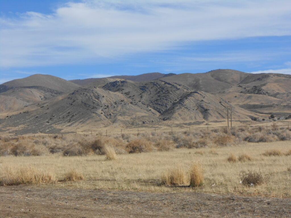
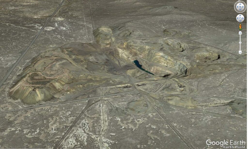
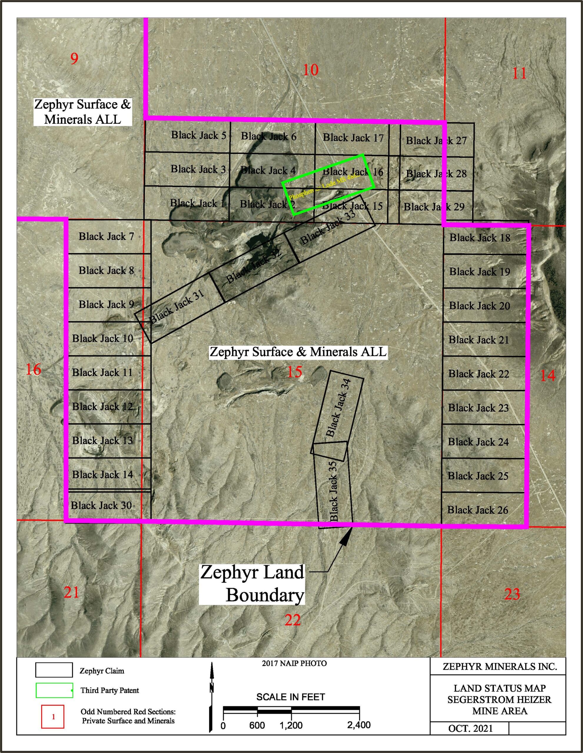
The Segerstrom – Heizer Mine (also referred to as SH Mine) is a legacy open pit mine that is located in Sections 9, 10, 14, 15, and 16, T25N, R34E in Pershing County, Nevada. Geographically, the SH Mine property is located approximately 3.5 miles southeast of the Thomas Mine property. Access to the property is from the Anderson Ranch Road that intersects the Coal Canyon Road approximately 1.5 miles north of the Thomas Mine. The property consists of two sections of fee land (1280 acres) and 34 unpatented claims on BLM administered land (approximately 650 acres), Historic mining was performed for iron ore between 1943 and 1966 – principally in Section 15, a fee section, however small pits were developed on BLM land in sections 10 and 16. Waste rock and low grade material from legacy operations were placed in stockpiles on Section 10 that are now within the property package. Visit our Projects Page for more information.